
")
Product Description
Price: $14.95 - $13.90
(as of May 16, 2025 00:23:37 UTC – Details)
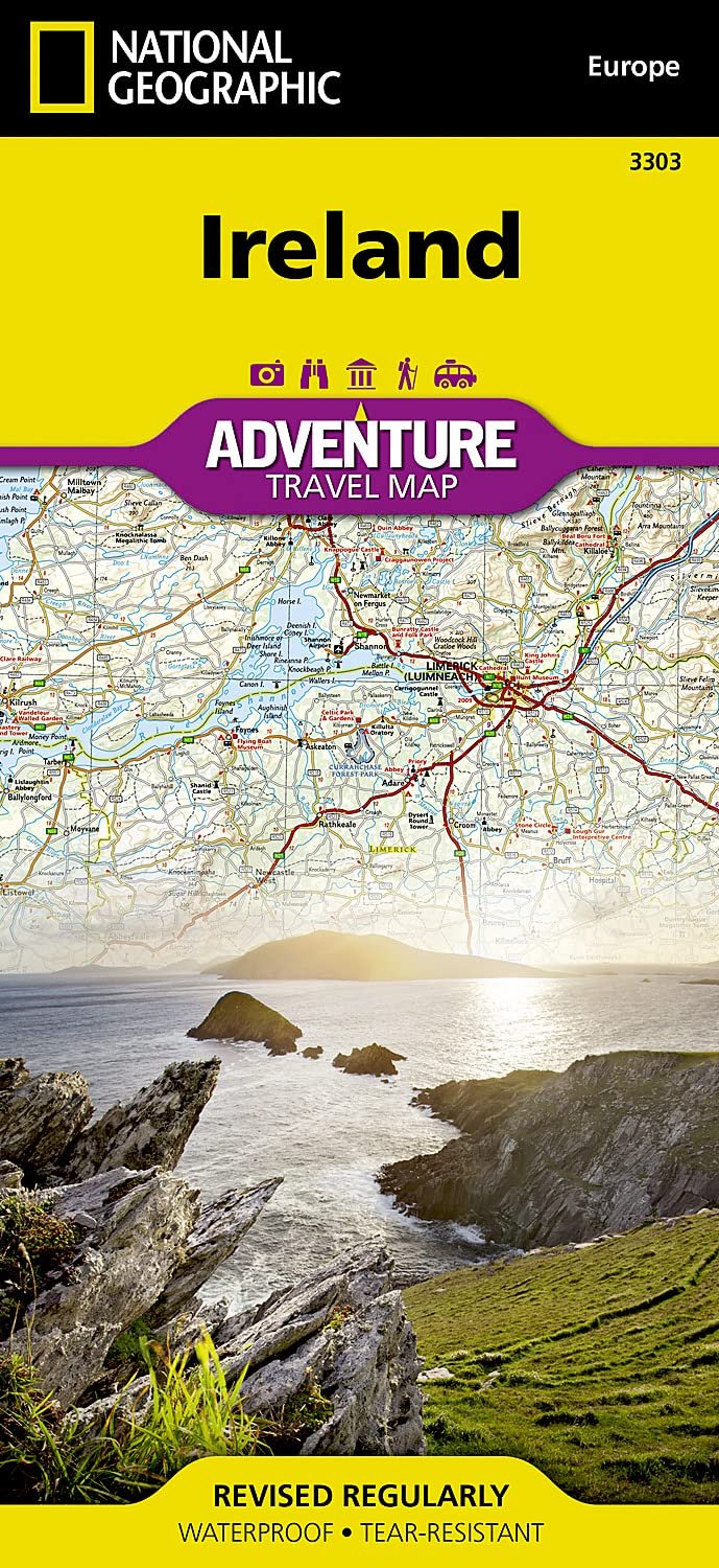
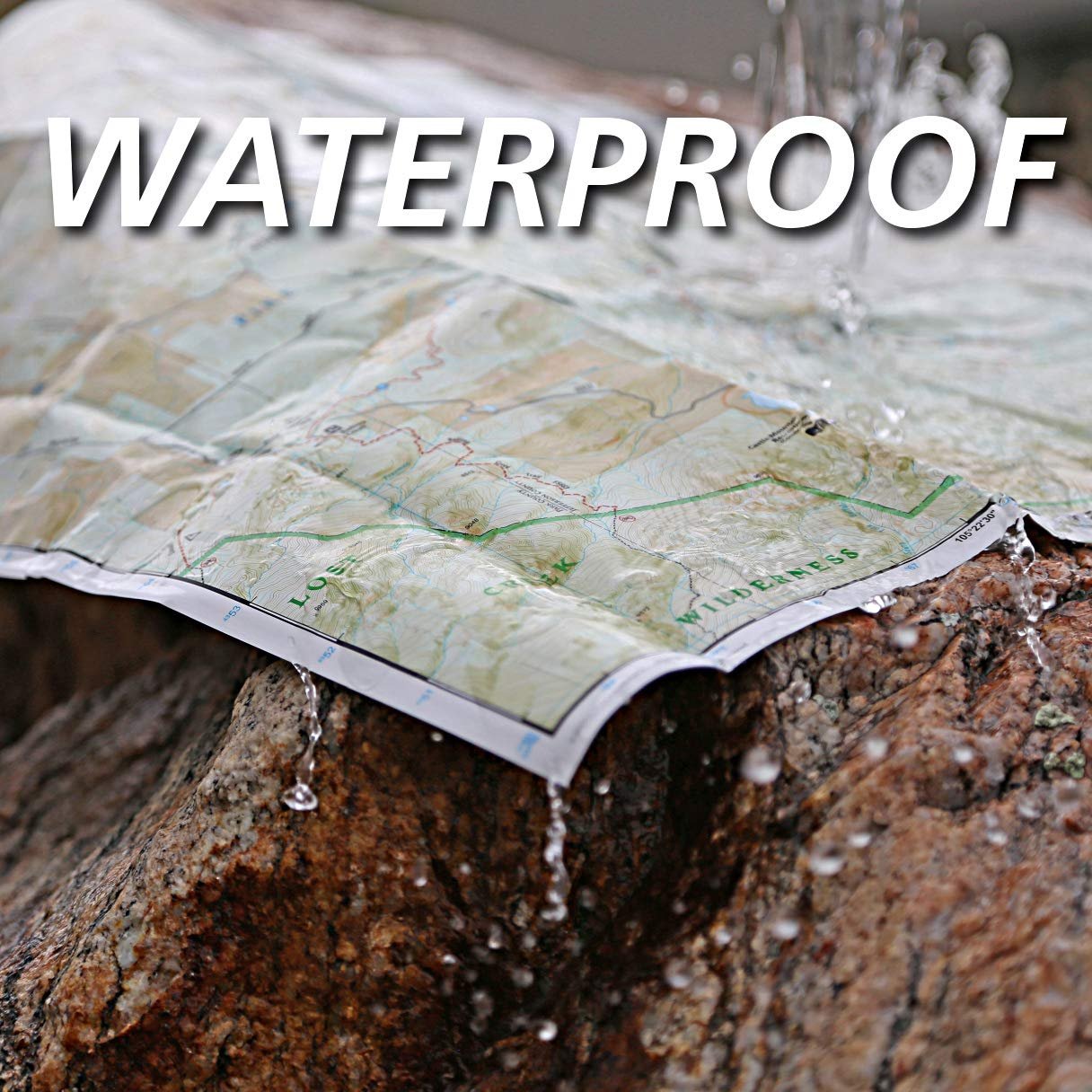
• Waterproof • Tear-Resistant • Travel Map
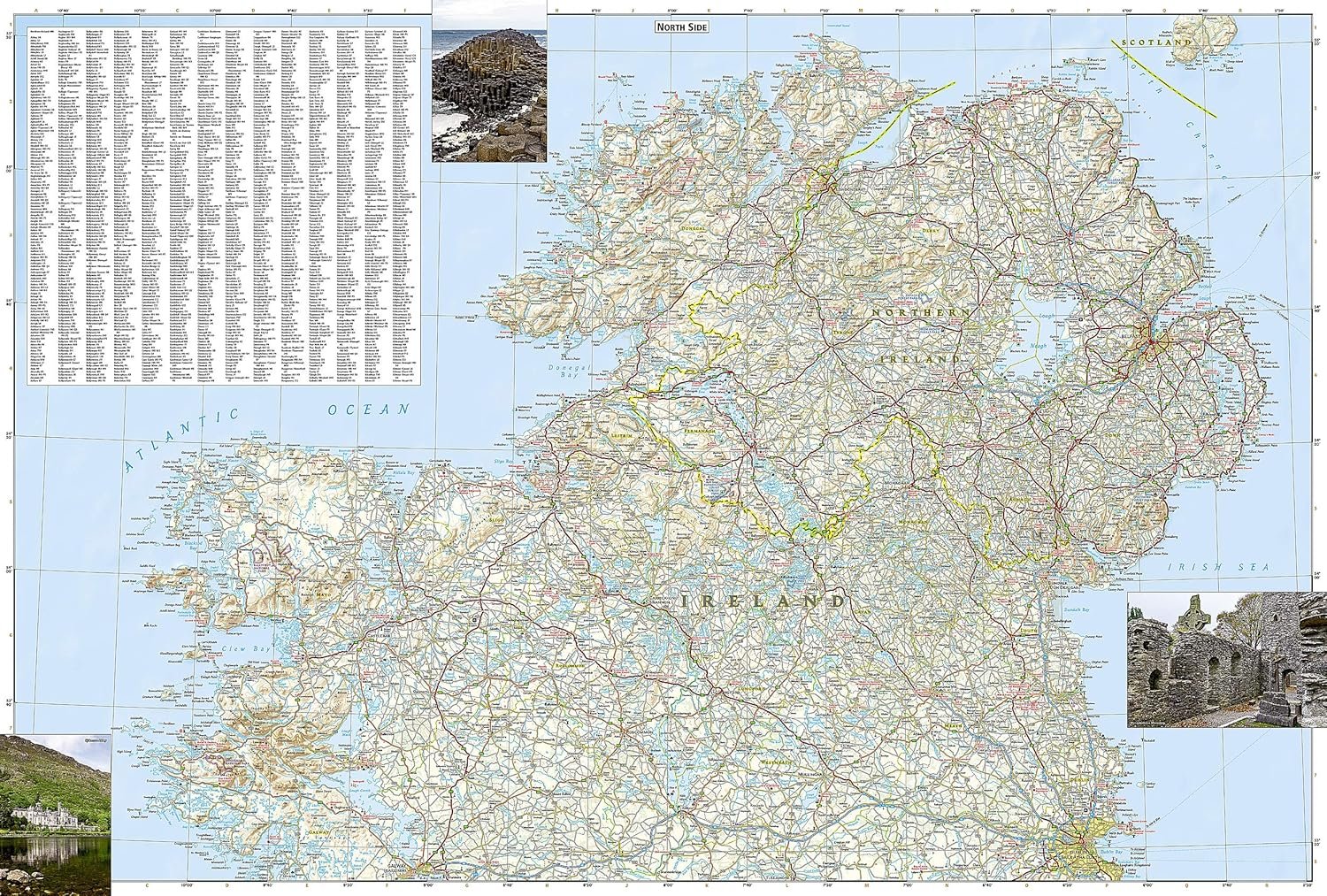
Explore the storied “Emerald Isle” with National Geographic’s Ireland Adventure Map. Designed to meet the needs of adventure travelers with its detailed, accurate information, this map includes the location of cities and towns with a user-friendly index and a clearly marked road network complete with distances and designations for roads/highways, plus secondary routes for those seeking to explore off the beaten path. Specialty content such as hundreds of diverse and unique recreational, ecological, cultural, and historical destinations make Adventure Maps the perfect companion to a guidebook.
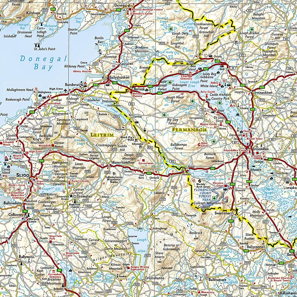
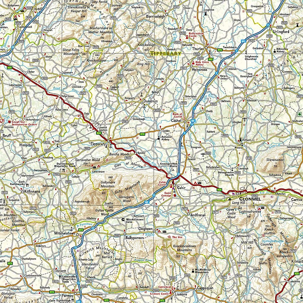
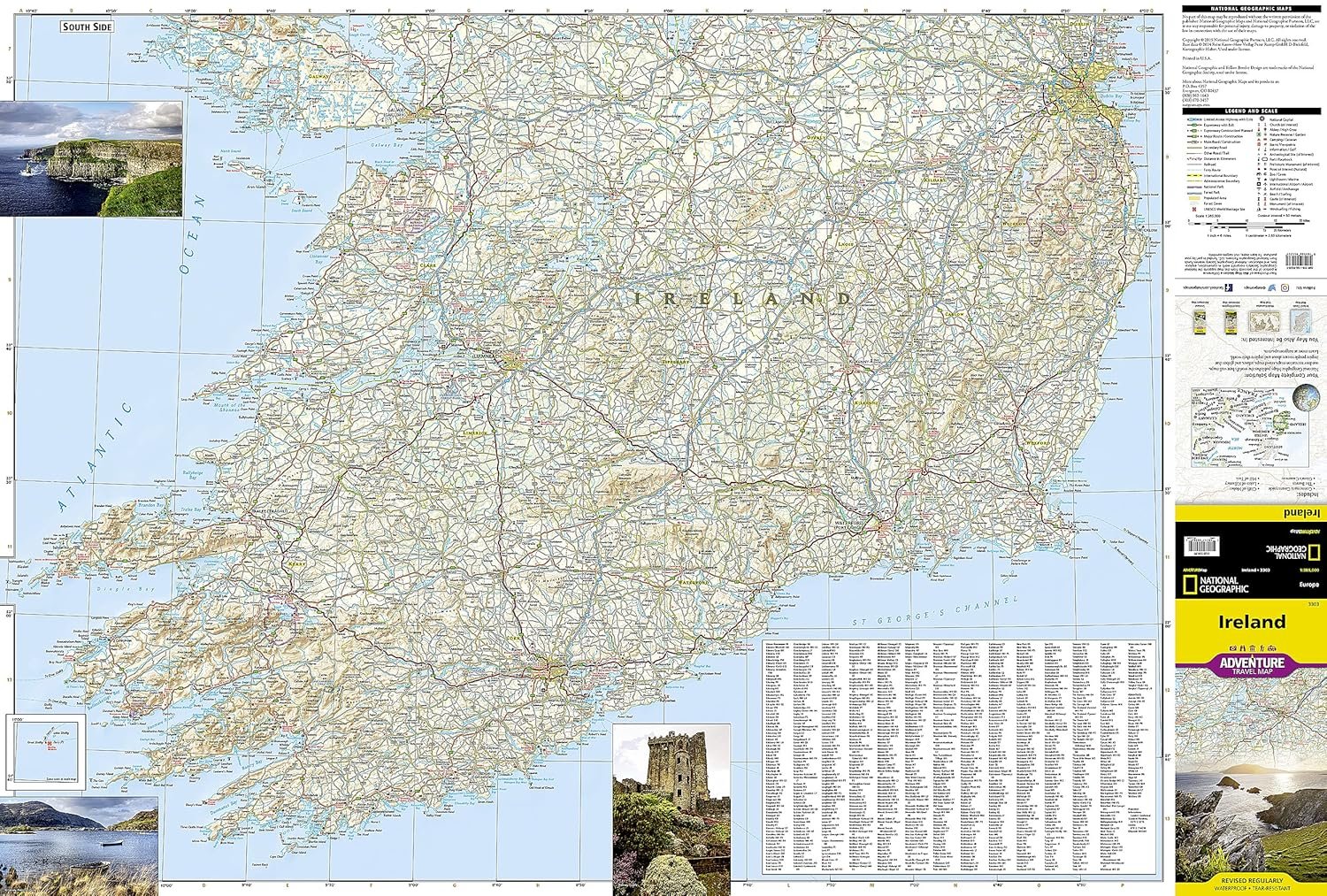
The Ireland Adventure Map covers the entire island including the Republic of Ireland and British-ruled Northern Ireland in one easy-to-use map. The north side of the map details from the northernmost tip of the island at Malin Head south to Dublin and Galway, including Belfast, Dundalk, Londonderry, and Sligo. The south side overlaps the northern side of the map at Galway on the west and Dublin on east, covering the remainder of the country including the cities of Limerick, Tralee, Cork, and Waterford.
Ireland’s lush green landscape is a result of its temperate, oceanic climate. The island’s geography is mostly comprised of a central plain surrounded by relatively low-lying mountains. Coastal regions vary from sandy beaches to towering cliffs that rise hundreds of feet above the pounding surf. Castles, churches, abbeys, monasteries, and Neolithic sites abound, offering travelers a remarkable variety of opportunities to explore Ireland’s rich and ancient cultural history.
Every Adventure Map is printed on durable synthetic paper, making them waterproof, tear-resistant and tough — capable of withstanding the rigors of international travel.
Map Scale = 1:385,000Sheet Size = 37.75″ x 25.5″Folded Size = 4.25″ x 9.25″
From the brand

Europe Adventure Maps
Maps with Flags & Facts
World Maps
National Park Maps
National Geographic Travel
Publisher : Natl Geographic Society Maps; 2019th edition (January 1, 2019)
Language : English
Map : 2 pages
ISBN-10 : 1566955351
ISBN-13 : 978-1566955355
Item Weight : 3.21 ounces
Dimensions : 9.25 x 0.16 x 4.25 inches
Customers say
Customers find this Ireland map excellent for road trips, with good detail and easy readability, and one customer notes it’s better than smartphone and GPS maps for finding points of interest. The map is helpful for planning day trips and finding out-of-the-way places, and customers appreciate its waterproof coating that holds up well to dampness. They like its foldability and consider it worth the price, with one customer specifically mentioning it’s great for driving the freeways of Ireland.


Reviews
There are no reviews yet.